by Meteorologist Jeb Postle
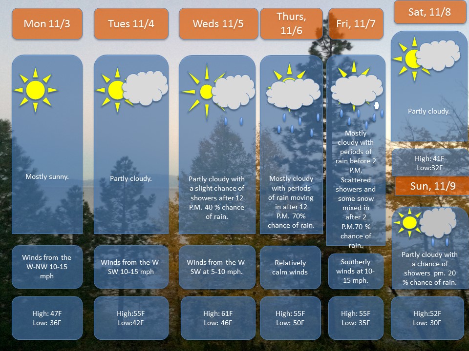
The nasty coastal storm that brought clouds, rainy conditions and even snow to parts of the region will depart the region late Sunday night-early Monday morning. A ridge of high pressure will build in from the south, providing a return of sun and warmer temperatures for the first half of the week.
The nice weather won’t last long, as a cold front will move through the region on Wednesday, bringing with it a chance of showers late in the day. The bad news is that this front will stall over the region, allowing for a storm system to move in from the south and west on Thursday into Friday. Right now, there could be some snow flakes mixing in with the leftover rain showers late Friday evening.
The weekend is looking dry and cool, with partly cloudy skies and a chance of showers for Sunday.