by meteorologist Jeb Postle
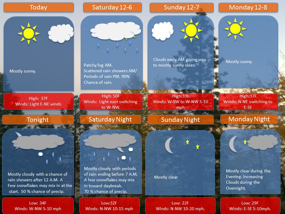
A ridge of high pressure will continue to provide dry weather to the region through today. however, the ridge will break down as a storm system will move in from the Ohio River Valley starting early Saturday morning. There may be some snowflakes mixing in with the rain showers early Saturday morning, as some pockets of cold air may linger. Afterward, a southwesterly flow will help usher in warmer temperatures, along with clouds and periods of rain mainly during Saturday afternoon and evening.
The storm system will move out of the area by early Sunday morning. With a cold front moving through the area early Sunday morning and there being leftover rain showers, there is a small chance of some snowflakes mixing in with the rain. Afterward, another ridge of high pressure will build in over the region providing dryer weather and another reinforcing shot of cold air for Sunday and Monday.