
 by Meteorologist Jeb Postle
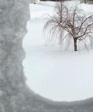
Arctic Tundra Continues, With A Chance Of Light Snow Tuesday Through Wednesday & During The Weekend
Alerts: The National Weather Service has issued a Wind Chill Warning, which remains in effect until 10 AM this morning.
Discussion: A ridge of high pressure will continue to build over the region on Monday, associated with sunny skies and cold temperatures. Also, the winds will remain gusty through the day as a tight pressure gradient remains over the region. At the same time, an area of low pressure is tracking across south central US. As the storm system moves off the coast of North Carolina tomorrow, it will strengthen. As of now, the track of the storm is farther to the south of the area. However, the area may get grazed with some periods of light snow Tuesday morning into the afternoon. As the storm moves farther out to sea late on Tuesday, a weak disturbance will move across the Great Lakes. This disturbance will keep the clouds over the area and provide a threat of isolated snow showers and flurries Tuesday night through Wednesday night.
A ridge of high pressure will build in from the south and west on Thursday and linger through Saturday morning. This will be associated with dry weather, but more cold weather. From Saturday afternoon into early Sunday morning, another disturbance will move through the region. There is a chance of more light snow for the area.
Note: With the current storm track for the system being more out to sea, this will provide perhaps a light accumulation of snow to the area during the day Tuesday. However, any shift closer to the coast will bump up the accumulations a tad bit and any track farther out to sea will mean nothing in the way of snow. Stay tuned.
