By Meteorologist Jeb Postle
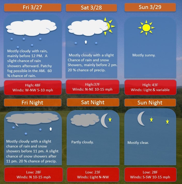
An area of low pressure will move out of the southeast Friday morning. Along with it, some moisture from the Gulf of Mexico will move along the front and clip the area with a chance of showers through midday Saturday. The good news is that the bulk of the moisture will remain out to sea.
A ridge of high pressure will build in from the west late on Saturday into the day Sunday. Expect mostly sunny skies and temperatures rebounding into the 40s. This will definitely be the pick of the weekend for doing any outdoor activities, spring-cleaning and running errands.
Next Week’s Outlook: A series of disturbances will move in from the Great Lakes on Monday and Wednesday, bringing a chance of rain showers. Late next week, the forecast shows a more potent storm system moving into the region from the west on Thursday and lasting into Friday morning.
Note: If anyone has any weather related questions or concerns, feel free to email me at jebril.postle@gmail.com