
by meteorology Jeb Postle
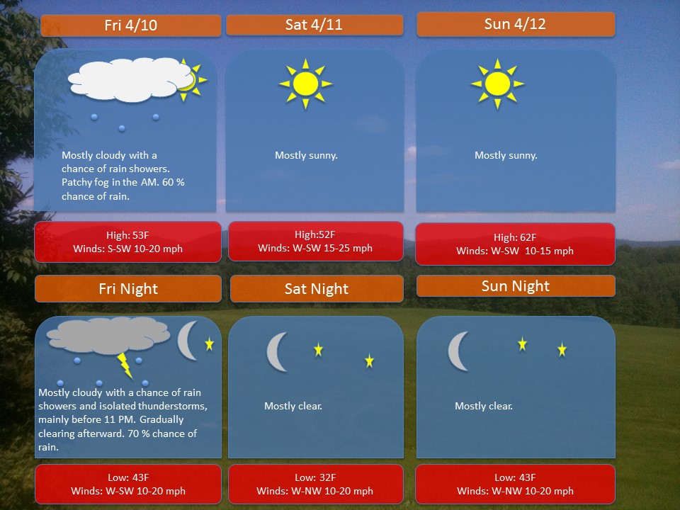
Overview: A warm front is moving through the region early this morning, associated with clouds, fog, and rain showers. Later this evening-night, a cold front will move through the area. This will be associated with another round of rain showers and a possible isolated storm. Behind this frontal passage, a ridge of high pressure will build in from the Midwest just in time for the weekend. You can expect mostly sunny skies and high temperatures in the 50s and 60s.
Outlook: Next week, a cold front will move through the area late on Monday into Tuesday morning. Afterward, a ridge of high pressure will build in from the west and provide dry weather till the weekend. Temperatures are looking to be around average to slightly above average next week.
Note: If anyone has any weather related questions, feel free to email me at jebril.postle@gmail.com

Open up Source Blog site – Open source at Google from information concerning Google’s open source
tasks as well as programs.