

by Christopher Setterlund
Setterlund captures journeys he makes on his blog ‘In My Footsteps’ where he finds “beautiful spots near and far looking for the things that make each and every town and city on earth special.” In 2010 he took a journey through Upton. If you would like to find out more about Setterlund you can visit his blog here http://christophersetterlund.blogspot.com/ or check out his book – In My Footsteps: A Cape Cod Travel Guide.
Upton Daily Note: A portion of the Sweet Williams Farm property was preserved by the Town of Upton after Trip 69 was published. 63 acres are now owned by the town and 35 acres remain in private ownership, protected by a conservation restriction. The town owned portion of the farm, the Whitney Conservation Area, is open to the public. Trails are established on the eastern portion of the Whitney Conservation Area.
In My Footsteps
Christopher Setterlund
Trip 69: Upton, Massachusetts
August 18, 2010
The Blackstone River Valley is one of the best places in Massachusetts to visit if you want to be nearly overwhelmed with breathtaking beauty. Many of the twenty-four towns in Massachusetts and Rhode Island that make up the Valley area are rural and this allows for seemingly endless miles of amazing views. Upton is one such town.
Settled in 1728 Upton was originally the home of the Nipmuc tribe of Native Americans. It is also the spot of the first ever performance by Aerosmith in 1970 at Upton-Menden Regional High School which was then known as Nipmuc Regional High School. I got a great feel for this amazing little town upon arrival at the town center. I particularly enjoyed the view I got while standing near the porch of the Ezra Nelson House which is situated up on a hill. From this point I got a great look at the Town Hall, Library, and the small green which housed a very nice Civil War monument. I found myself snapping photos of the view so that I could remember the feeling as well as the beautiful buildings. I made sure to take a walk around the town center and really enjoyed the small town feel. This was driven home by the nice ladies at the Town Nurse’s Office on Grove Street who let me use their bathroom. Thank you!
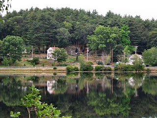
I next visited Pratt Pond which is a short drive from the town center on Hopkinton Road. There were many exquisite views but in a sort of twist these sights were best seen from the edge of the adjacent Lakeview Cemetery. Yes, in order to get some great shots of the reflections of buildings on the water I spent some time wandering around a deserted cemetery. Still, it was worth it as the views of Kiwanis Beach across the pond and the homes on Hopkinton Road reflecting on the water were sights I will remember.
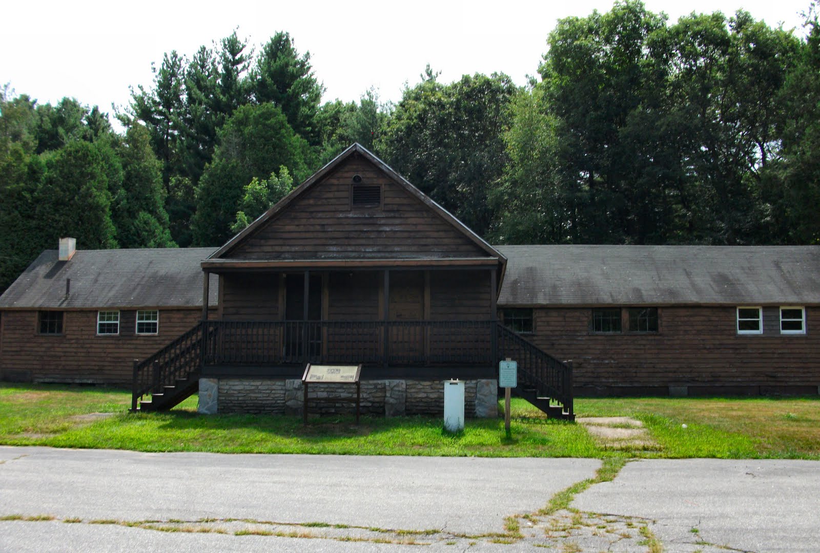
Upton State Forest is filled with amazing sights and even the drive through it was spectacular. It is 2,660 acres of hiking and walking trails, as well as places for horseback riding and snowmobiling in the winter. One thing I found particularly interesting was found at the main entrance. There you will find a plaque with a photo in front of a rectangular wooden cabin. The photo and words on the plaque tell of the contributions that were made to the Upton State Forest by a group called the Civilian Conservation Corps.
The Civilian Conservation Corps (CCC) was a group put together by President Franklin D. Roosevelt as part of his ‘New Deal’ in 1933. At its peak there were three million people working for the CCC. There were some very famous people who at one time were associated with the CCC, they include names like Walter Matthau, Chuck Yeager, Archie Moore, Raymond Burr, and Stan Musial. All in all the Civilian Conservation Corps planted more than three billion trees, built more than 800 parks that were the start of the state parks, developed forest fire fighting methods, and created a network of thousands of miles of public roadways. The CCC program ended in 1942 but its legacy lives on in other conservation groups still active today.
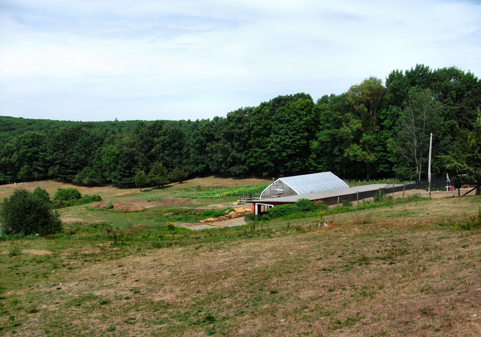
I began by mentioning how seemingly everywhere I looked in Upton, and the entire Blackstone River Valley for that matter, there were incredible views as far as I could see. This fact came to a perfect head when it was mixed together with a few farms located to the north and west of Upton State Forest. There are others such as Stefans Farm on Mechanic Street but I stopped at Sweetwilliam Farm on North Street and was in awe of the view. The farm land sloped out before me and then the greens of the forest took off and rose up as far as I could see. I felt as if I was at a point in the Blackstone River Valley where I was on a high point in the middle and was able to be sort of at eye level with the other high points. I mean the valley sloped down away from me and rose up to meet my eye level at a distance several miles away. It was amazing!
Sweetwilliam Farm itself is not a gigantic farm, at least as far as I saw, but I really enjoyed my time there. Though there were lots of chickens and horses on the grounds there is a lot more that goes on at Sweetwilliam Farm. There is a beautiful country store which they call a ‘little piece of Vermont,’ the farmhouse sports the name Ephraim Whitney Jr., an uncle of Eli Whitneythe inventor of the cotton gin in 1794. The house is dated 1780. There are yoga and Native American classes on the grounds as well as live music Friday nights during the summer. There are so many reasons to make a stop at Sweetwilliam Farm.
Upton is a small town with as many beautiful views as any other town I have visited. This became even more evident as I traveled throughout more of the Blackstone River Valley that I was in a very special area of Massachusetts. I believe that Upton is a great way to introduce yourself to the breathtaking beauty of the Blackstone River Valley; although to be honest every place I visited there was incredible. Check out the history of the CCC at Upton State Forest and immerse yourself in culture, history, and delicious treats at Sweetwilliam Farm. Have fun and happy traveling!
Directions: Upton State Forest: From I-495 south take Exit 21B for Upton. Turn right and drive 3.5 miles. Turn right onto Westboro Road, entrance is 2 miles up on the right.
Sweetwilliam Farm: From I-495 south take Exit 21B for Upton. Turn right and drive 3.5 miles. Turn right onto Westboro Rd. Travel 1.3 miles and make a left onto North Street. Sweetwilliam Farm is 1.4 miles up on the right.
References: Sweetwilliam Farm
Upton, Ma. – Official Town Site
