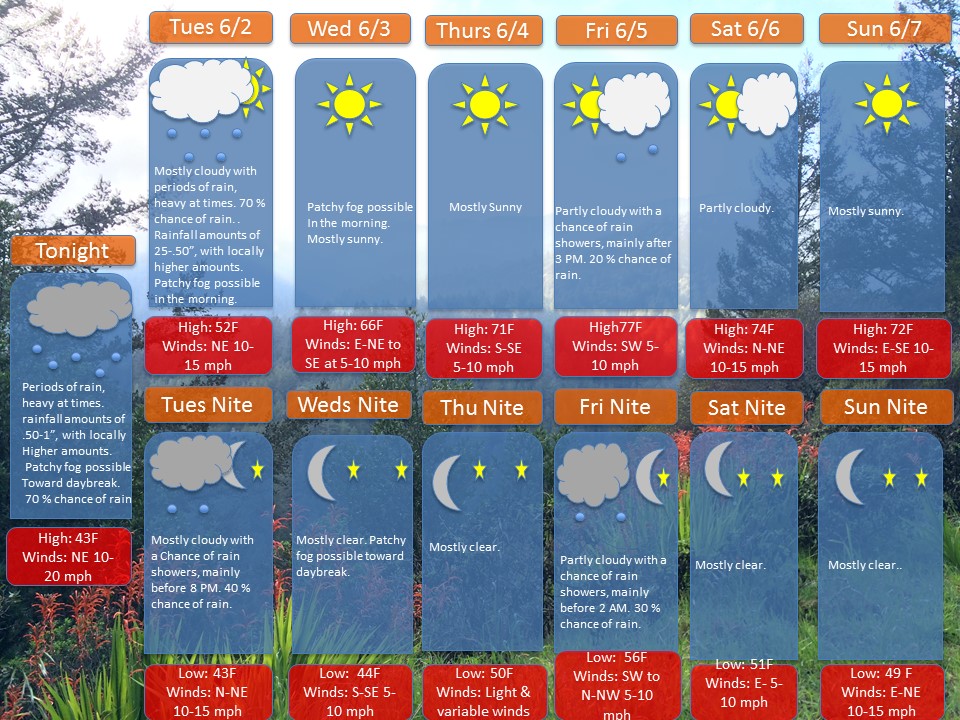
Overview: A stationary front is currently positioned just to south of the area. At the same time, a series of disturbances will move along the frontal boundary, bringing in rounds of rain. Late on Tuesday into the day Wednesday, a ridge of high pressure will move in from the west. This will provide a return of dry weather to the area. Late on Friday, a warm front will move through the area. There will be chance of rain showers associated with this frontal passage. The upcoming weekend is looking mostly dry and warmer, with high pressure forecasted to move in from the north and west. High temperatures as of now are forecasted to be in the 70s.
The upcoming weekend is looking mostly dry and warmer, with high pressure forecasted to move in from the north and west. High temperatures as of now are forecasted to be in the 70s.
Note: If anyone has any weather related questions, feel free to email me at jebril.postle@gmail.com


