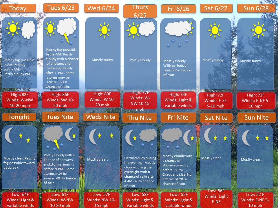
Overview: A ridge of high pressure will provide nice weather for Monday. Afterward, a warm front will move through the area Tuesday morning. This will followed by a cold front Tuesday afternoon and evening. This front will spark some showers and storms, of which some may be severe.
A ridge of high pressure will build in from the west on Wednesday and continue into the day Thursday. Late Thursday night into the day Friday, A storm system will move in from west. As of now, the weekend is looking mostly dry and cool, with high temperatures in the low to mid 70s.
Note: If anyone has any weather related questions or concerns, feel free to email me at jebril.postle@gmail.com