
 Meteorologist Jeb Postle
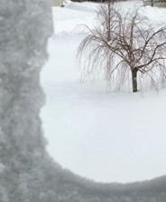
Discussion: Impressive cold weather showed up this weekend. An Arctic Airmass settled over the area this weekend and allowed for some good cold air advection to occur. Low temperatures around -10F were found Sunday morning across the area, with dangerous wind chills as low as -40F. An area of high pressure will allow for the Arctic air mass to linger around through early tomorrow.
A disturbance (Clipper) moving through the upper midwest will move into the Ohio River Valley by later today. At the same time, an area of low pressure will develop along a stationary front across the southern US. This area of low pressure will move to the northeast and develop, as some energy from the clipper will transfer over. With a storm track over Pennsylvania right now, that would allow for predominately rain to fall from this. With cold air in place initially, there will be a period of some snow and a wintry mix during the onset.
During the day Tuesday into Tuesday evening, mild temperatures and heavy rain are likely. This may result in a localized flood threat with snow currently on the ground. As the storm moves out of the region on Wednesday, a cold front will move though the area late on Wednesday and provide some cooler temperatures.
The start of the weekend is looking a little stormy as of now, as a storm system will move in from the west. There may be a risk of a few rain and snow showers late Friday through early Saturday. High pressure will allow for dryer conditions for both Saturday and Sunday.
Impacts: This next storm late Monday into Tuesday will bring some minor impacts to the area. The light snow showers will begin to fall roughly between 3-7 PM Monday. Periods of light snow showers will gradually changeover to a wintry mix between 8-11 PM. Wintry mix will transition over to all rain after 2 AM. With this said, there should be minimal impacts during the Tuesday morning commute.
Snow and sleet accumulation of up to 1″ possible, along with a trace of ice possible.
